|
CUSPs Interactive Watershed Map
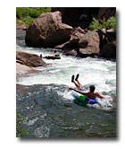
We live in the arid west, where water is our most precious resource. It is critical to not only our existence, but also to the existence of the unique plants and animals that call Colorado home. A watershed is defined as an area of land in which all rain, snowmelt, and smaller tributaries flow downhill into the same body of water. In our case, the watershed drains an area in the mountains on the east side of the Continental Divide to the foothills southwest of the Denver Metro area.
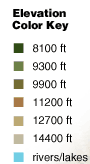
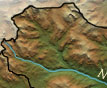
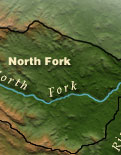
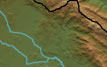
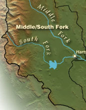
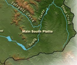
This digital terrain map outlines the watershed project area and three distinct geographic sections. Begin your exploration by choosing either of these sections. This will take you to a closer and more detailed terrain map. From there you can choose spots to begin a Virtual Tour while viewing high quality, interactive and immersive 360 degree panorama views
Enjoy your "Interactive Journey" into the watershed.
|